Viva la France!
10 French natural wonders
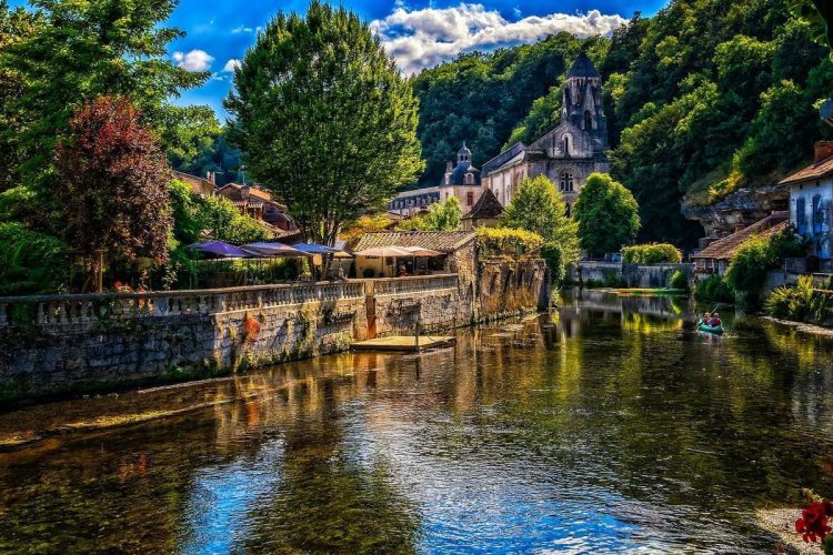
In this material there will be no champagne, Eiffel Tower, lavender fields of Provence and croissants, because everyone already knows about it. Today we want to recommend 10 unobvious wonders of this beautiful country - and there is a lot to talk about. France is surrounded by mountains, ocean and seas, in some areas endless summer reigns, while in others the temperature rarely rises above 20OC and rain is the usual thing. Mountain peaks and volcanoes, waterfalls and caves, rocky shores, beaches and nature reserves attract far fewer tourists than historical monuments and cultural attractions. We need to fix it!
Provençal Colorado (Rustrelle ocher)
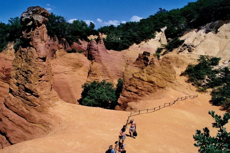
From the beginning of the 18th to the end of the 20th century, the largest ocher mining in Europe was carried out in the town of Roussillon in the Luberon Valley in Provence. In 1992, mining was stopped, and a reserve was opened on the site of the canyon, which looks very futuristic thanks to the red rocky landscapes and colorful houses. Such views you expect to see in Colorado in America, but not in the quiet green Provence!
In the picturesque Sentier des Ocres (ochre reserve), there is a walking route lasting about 40 minutes. We recommend visiting this canyon at sunrise or sunset, when the ocher plays with hundreds of shades. You can get to the quarry by bus from Avignon or Aix-en-Provence, or by car along the A7, D900 or N100 highways.
Bay of Mont Saint Michel
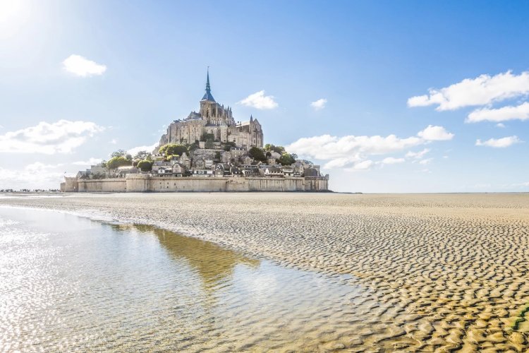
Both the bay and the medieval fortress on the border of Normandy and Brittany, which are on the UNESCO World Heritage List, bear the name Mont Saint-Michel. The uniqueness of this place lies in the fact that at high tide the fortress becomes an island, almost completely cut off from the mainland, and you can only pass through a dam built at the end of the 19th century. When the water recedes, the territory of Mont Saint-Michel again becomes an extension of the coastline. The ebbs and flows here are the most powerful in Europe, the water "travels" along the 15-kilometer bay twice a day.
Much is known about the fortress itself: back in 709, monks founded it, during the Hundred Years War it was besieged for 30 years and could not be taken, and since the French Revolution it was converted into a prison like the Bastille. It's definitely worth visiting this place! The road to Mont Saint-Michel lies along the routes A11, A13 and A84 for motorists, as well as buses and trains from Paris and Rennes.
Chalk cliffs of Etretat
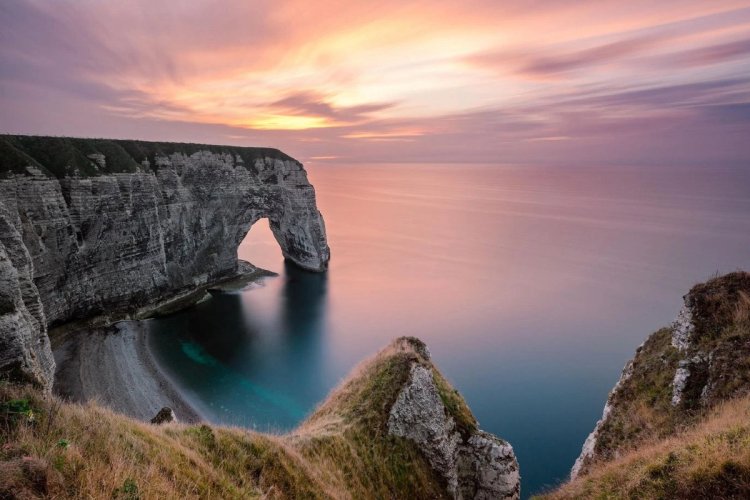
The Alabaster Coast, located in the Normandy region of northern France, spans 200 kilometers of the Atlantic Ocean. It received this name due to the snow-white coastal rocks. Especially picturesque rocky arches, secluded bays and majestic cliffs can be found in the vicinity of the small town of Etretat. In the 19th century, this town became a favorite place for impressionist painters, in particular Claude Monet, who depicted its rocks in many of his paintings. Today, hiking trails of varying complexity and length with signs are laid along the most famous rocks and cliffs. You can get to Étretat by bus from Le Havre or Paris, or by car on the D940 from Le Havre, on the A151 and A29 from Rouen, or on the A14 and A29 from Paris.
Dune in Pyla
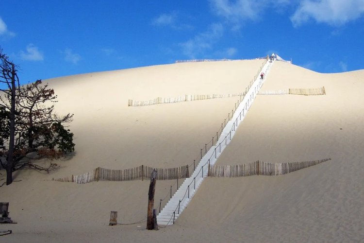
Located in Aquitaine on the Gulf of Arcachon, Pila dune is considered the largest sand dune in Europe. This place has eight thousand years of history: sand hills were formed on the coast as a result of the interaction of strong winds, ebbs and flows. With each decade, the dune moves deeper and deeper into the continent, gradually replacing forest thickets, roads and private houses, moving an average of five meters per year. The height of the Pyla is 108 meters, the width is about 500 meters, and the length exceeds 3 kilometers.
On one side, the dune is surrounded by a pine forest, and on the other side, by the waves of the Atlantic Ocean. At the foot of the dune, in the Gulf of Arcachon, there are many oyster farms, making it possible to order excellent seafood and oysters at affordable prices in nearby restaurants. Wooden stairs are installed for the convenience of climbing to the top of the dune. The nearest major city is Bordeaux, from where you can get to the dune by bus or train. To avoid crowds of tourists, it is recommended to visit the dune before 11 am.
Verdon Gorge
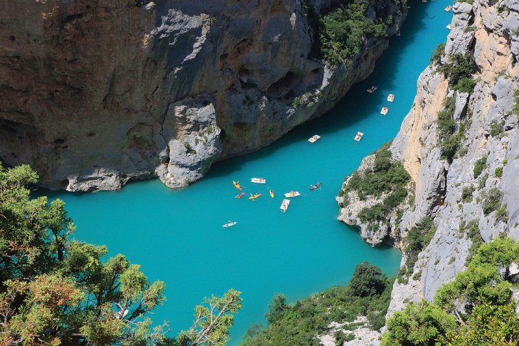
The Verdon Gorge, located in the foothills of the Alps, about 50 kilometers from the Mediterranean Sea, is the deepest in Europe. The most picturesque part of it is the Grand Canyon du Verdon, which stretches between the villages of Castellane and Moustiers-Saint-Marie. For many millennia, the Verdon River has cut its bed in the soft limestone of the Alpine foothills, and now the width between the “shores” of the Provencal Grand Canyon is up to 1500 m, and the depth is almost 700 meters. The water in the river and in the Sainte-Croix Lake has a unique emerald hue that contrasts with the light rocks of the gorge, lush Provencal vegetation and the blue southern sky.
Travellers can explore the Grand Canyon along the D71, D90 and D23 roads, or choose from a dozen hiking trails of varying difficulty. For those arriving from Nice, the largest nearby city, a bus is available to the Verdon Gorges.
Camargue Natural Park
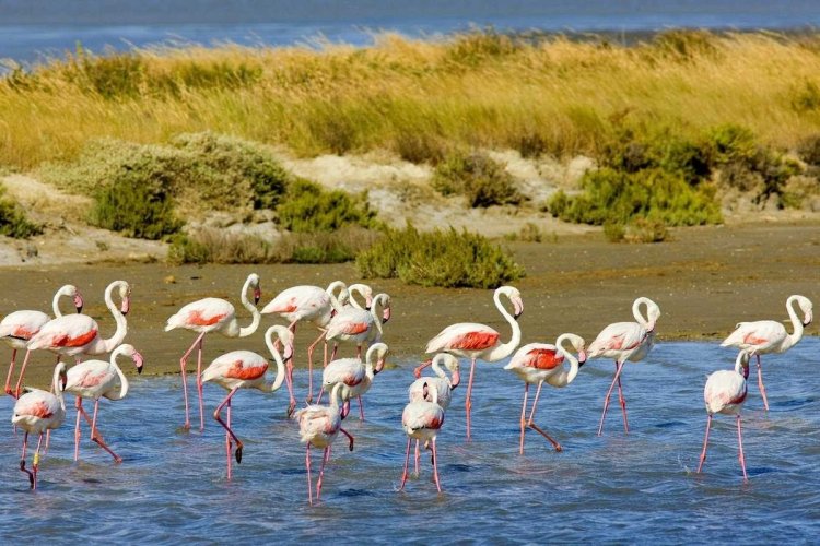
The Camargue is a natural reserve located in the south of France, near the Mediterranean Sea and the city of Arles. This area is distinguished by its unique landscape, including salt lakes, sea lagoons, reed marshes and sandy islands. Pink flamingos, black bulls and wild white horses live here, which cannot be found anywhere else in Europe. Horses and bulls live and prosper throughout the whole park, while flamingos can predominantly be found only in the Pont de Gau ornithological park along with another 260 species of birds. It is most convenient to travel around the Camargue by car, but you can also walk - there are a lot of hiking trails in the park. In summer, boats and mini-trains run from Saintes-Maries-de-la-Mer to the Camargue, as well as buses from Arles and Montpellier.
Volcano Park in Auvergne
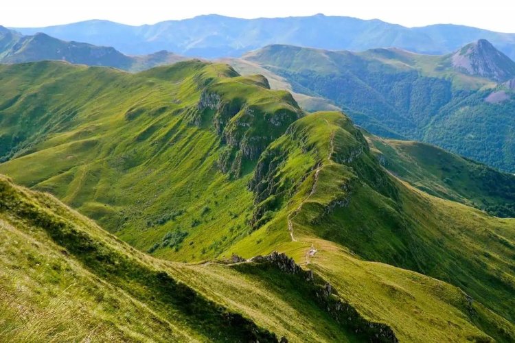
The Auvergne Volcanic Park, located in south-central France, is the largest national natural reserve. Within its boundaries there are 80 long-extinct volcanoes of various shapes and sizes: the highest of them are the Chaîne des Puys mountain range, which includes Puy-de-Dôme, reaching a height of 1465 meters.
Puy de Sancy with a height of 1886 meters and Puy Mary (1783 meters) are quite popular among tourists, so it is easy to get here by car. You can reach their base on your own using the routes A72, A71 and A89, or as part of a group by shuttle from the train station in Clermont-Ferrand. The empty craters of these volcanoes can be explored by climbing to the top on foot or on horseback. Cycling and hiking trails are laid between the main volcanoes and throughout the nature reserve.
Piana's calanques
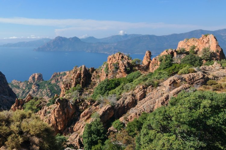
Calanques are unique rock formations made of pink granite, which, under the influence of erosion and time, take intricate shapes. They form calm bays and caves in the rocks, rising with sharp peaks to a height of more than 300 meters. Pine and chestnut forests grow on the slopes of these rocks, and their feet are washed by the waters of the Mediterranean Sea. The Calanques of Piana are located in the Scandola National Nature Reserve in the Gulf of Porto on the island of Corsica and are part of the UNESCO World Heritage List. In order to enjoy the views of these cliffs, you can choose between two options: go on a boat trip from Porto, which will sail past the most picturesque corners, or follow one of the walking routes leading from Porto through Cargese.
Mer de Glace Glacier
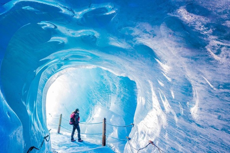
The Mer de Glace glacier, starting at the foot of Mont Blanc in the Western Alps on the border between France and Italy, descends into the Chamonix valley. This glacier is constantly moving, passing every year a distance from 90 to 120 meters. Its area is 40 square kilometers and its length is 13 kilometers, making it the largest glacier in France. Tourists started visiting it as early as the 19th century, and today visitors can enjoy the view of the glacier not only from the railway route that passes over it, but also from inside.
Inside the picturesque 200-meter glacier, a long tunnel was laid, including dozens of corridors and caves with multi-color illumination. Near the glacier there is also a mineral museum, viewing platforms and hiking trails leading into the valley. You can easily get to Montenvers station at the foot of the mountain by train, bus or car, but the top of the glacier can only be reached by an old red train that has been running since 1908.
Grotto Aven Arman
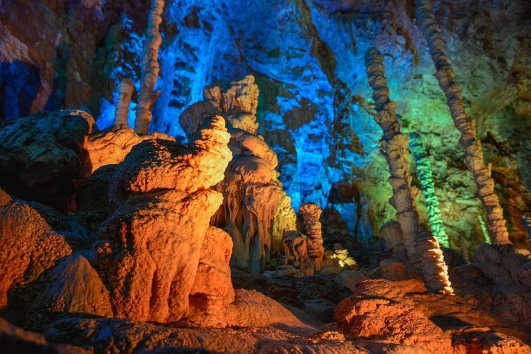
Grotto Aven Armand, located on the limestone plateau Cosse Mezhan in Occitania in southwestern France, is famous for having the largest stalagmites in the world. Some of them rise to 15-20 meters, and the highest reaches 30 meters! In total, there are more than 400 stalagmites in the grotto. For the convenience of visitors, a special funicular was built, which lowers them to a depth of 50 meters along a tunnel leading to a huge cave, illuminated by bright light. The dimensions of the cave are impressive: the length is 110 meters, the width is 60 meters, and the height is 45 meters. Visitors are offered free guided tours every hour, and the main stalagmites are illuminated in different colors. You can get to the grotto by bus from the city of Rodez, although it is most convenient to go by car along the RN 586 road.
France is one of the most popular destinations among tourists from all over the world. Imagine how surprised your loved ones will be when they find out that you chose to go to the natural park to look at the caves instead of standing in line for the Mona Lisa at the Louvre or tasting 100 types of red wine from the Bordeaux region! On your next trip to natural wonders, don't forget to buy a fedafone eSIM for France to stay connected in the most remote corners of this magnificent country.
